
1968 Map of Swift Reservoir
USGS Topo · Published 1971About this map
Lewis and Clark National Forest dominates this high-altitude landscape, where the Eastern Front of the Rockies meets the Blackfeet Indian Reservation Boundary. The primary water feature is the Swift Reservoir, controlled by Spillway 4884 and fed by the converging waters of Birch Creek and its many tributaries, including North Fork Birch Creek and South Fork Birch Creek. The terrain is characterized by massive peaks and ridges, most notably Feather Woman Mountain, Mount Poia, and the sharp crest of the Backbone. This survey, field-checked in the late 1960s, documents a complex drainage system where Whitetail Creek and Haywood Creek carve through the foothills. Evidence of local geography and land use is found in labels like Killem Horse Creek and the high Mowitch Basin, illustrating the intersection of federal forest land and indigenous reservation territory.
Find a feature on this map
29 named features on this map. Tap any name to fly to it.
Don’t see what you’re looking for? This feature index may not catch every label — zoom into the map to look around manually.
Map Details
Editions of this 1968 Swift Reservoir Map
2 editions found
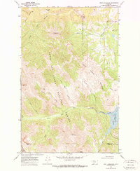
Other maps of this area

1913 · Marias Pass
USGS Topo · 1:125,000

1914 · Heart Butte
USGS Topo · 1:125,000

1918 · Heart Butte
USGS Topo · 1:125,000

1960 · Cut Bank
USGS Topo · 1:250,000

1963 · Cut Bank
USGS Topo · 1:250,000

1964 · Cut Bank
USGS Topo · 1:250,000

1968 · Half Dome Crag
USGS Topo · 1:24,000
1968 · Gateway Pass
USGS Topo · 1:24,000

1968 · Fish Lake
USGS Topo · 1:24,000
1968 · Gooseberry Park
USGS Topo · 1:24,000