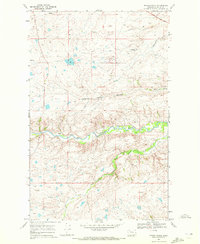
1968 Map of Magee Ranch
USGS Topo · Published 1972About this map
The Lewis and Clark Trail crosses the northern landscape of this region within the Blackfeet Indian Reservation, tracing a historic path through the drainage of the Two Medicine River. The terrain is defined by complex erosional features such as Big Nose Coulee and the deep winding beds of Little Badger Creek and Badger Creek. The namesake Magee Ranch stands as the primary namesake settlement in a territory otherwise dominated by seasonal springs and topographical variations that dictated early ranching and passage. This 1968 field-checked survey reveals the intricate relationship between the river systems and the historic overland routes that shaped travel across the Montana plains.
Find a feature on this map
8 named features on this map. Tap any name to fly to it.
Don’t see what you’re looking for? This feature index may not catch every label — zoom into the map to look around manually.
Map Details
Editions of this 1968 Magee Ranch Map
This is the sole edition of this map. No revisions or reprints were ever made.
Other maps of this area

1901 · Browning
USGS Topo · 1:125,000

1903 · Browning
USGS Topo · 1:125,000

1911 · Blackfoot
USGS Topo · 1:125,000

1913 · Marias Pass
USGS Topo · 1:125,000

1914 · Heart Butte
USGS Topo · 1:125,000

1918 · Heart Butte
USGS Topo · 1:125,000

1960 · Cut Bank
USGS Topo · 1:250,000

1963 · Cut Bank
USGS Topo · 1:250,000

1964 · Cut Bank
USGS Topo · 1:250,000

1968 · Half Dome Crag
USGS Topo · 1:24,000