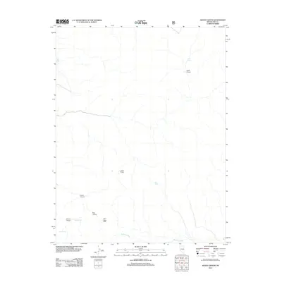
2012 Map of Heath Canyon
USGS Topo · Published 2012About this map
The Grant Range dominates this corner of Nye County, where the topography is defined by sharp drainage systems and vital water sources in a high-desert environment. This 2012 survey documents a series of critical watering points such as Heath Springs, Upper Blind Spring, and Mud Spring, which have historically served as essential landmarks for navigation and survival in the Great Basin.
Find a feature on this map
12 named features on this map. Tap any name to fly to it.
Don’t see what you’re looking for? This feature index may not catch every label — zoom into the map to look around manually.
Map Details
Editions of this 2012 Heath Canyon Map
This is the sole edition of this map. No revisions or reprints were ever made.
Other maps of this area

1956 · Lund
USGS Topo · 1:250,000

1960 · Lund
USGS Topo · 1:250,000

1964 · Blue Eagle Springs
USGS Topo · 1:62,500

1964 · Currant
USGS Topo · 1:62,500

1964 · Troy Canyon
USGS Topo · 1:62,500

1964 · Forest Home
USGS Topo · 1:62,500

1980 · Duckwater
USGS Topo · 1:100,000

1988 · Quinn Canyon Range
USGS Topo · 1:100,000
1990 · Troy Canyon
USGS Topo · 1:24,000
1990 · Wells Station
USGS Topo · 1:24,000