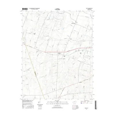
2016 Map of Heath
USGS Topo · Published 2016About this map
The McCracken and Ballard County line divides this Western Kentucky landscape, where several uniquely named settlements like Cimota City and Ceredo punctuate the rolling terrain. The area is dominated by the modern infrastructure of Barkley Regional Airport and the strategic crossroads near Heath and Grahamville. This modern survey reveals a dense network of local cemeteries, including Saint Thomas Cem, Quarles Cem, and Palestine Cem, which serve as vital markers for genealogical research in this rural pocket west of Paducah.
Find a feature on this map
93 named features on this map. Tap any name to fly to it.
Don’t see what you’re looking for? This feature index may not catch every label — zoom into the map to look around manually.
Map Details
Editions of this 2016 Heath Map
This is the sole edition of this map. No revisions or reprints were ever made.
Other maps of this area

1926 · Paducah
USGS Topo · 1:62,500

1928 · La Center
USGS Topo · 1:62,500

1929 · Paducah
USGS Topo · 1:62,500

1932 · La Center
USGS Topo · 1:62,500

1936 · Melber
USGS Topo · 1:24,000

1940 · Paducah
USGS Topo · 1:62,500

1949 · Paducah
USGS Topo · 1:250,000

1950 · Paducah
USGS Topo · 1:250,000

1951 · Blandville
USGS Topo · 1:24,000

1951 · Melber
USGS Topo · 1:24,000