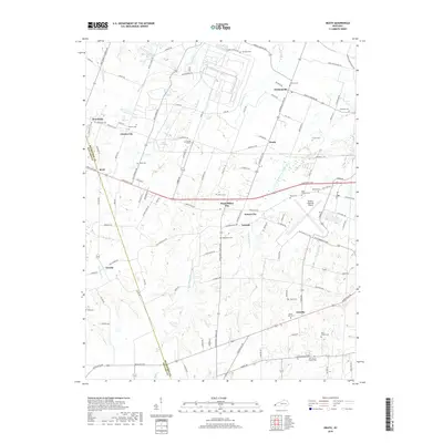
2019 Map of Heath
USGS Topo · Published 2019About this map
Barkley Regional Airport anchors this portion of Western Kentucky, where the headwaters of numerous creeks converge just south of the Ohio River. The landscape is defined by its small, clustered settlements including Grahamville, Heath, and the curiously named Future City and West Future City. The mapping reveals a dense network of country roads such as Ogden Landing Rd and Hinkleville Rd that link family farms to historic community centers. Genealogists will find a wealth of burial sites spanning the region, from Saint Thomas Cem near the airport to the remote McKendree Cem and Hills Chapel Cem. The drainage patterns of W Fork Massac Cr and Little Bayou Cr illustrate the natural topography that shaped early 20th-century land use in both Ballard and McCracken counties.
Find a feature on this map
113 named features on this map. Tap any name to fly to it.
Don’t see what you’re looking for? This feature index may not catch every label — zoom into the map to look around manually.
Map Details
Editions of this 2019 Heath Map
This is the sole edition of this map. No revisions or reprints were ever made.
Other maps of this area

1926 · Paducah
USGS Topo · 1:62,500

1928 · La Center
USGS Topo · 1:62,500

1929 · Paducah
USGS Topo · 1:62,500

1932 · La Center
USGS Topo · 1:62,500

1936 · Melber
USGS Topo · 1:24,000

1940 · Paducah
USGS Topo · 1:62,500

1949 · Paducah
USGS Topo · 1:250,000

1950 · Paducah
USGS Topo · 1:250,000

1951 · Blandville
USGS Topo · 1:24,000

1951 · Melber
USGS Topo · 1:24,000