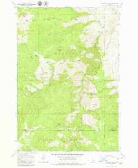
1964 Map of Heavens Gate
USGS Topo · Published 1979About this map
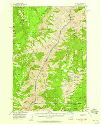
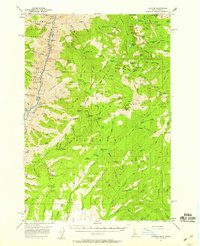
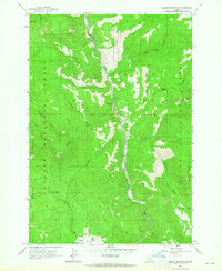
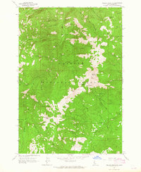
Nez Perce National Forest and Payette National Forest meet at a dramatic boundary line near the Rapid River. This mid-century survey records a landscape shaped by remote outposts and high-altitude springs, including the Rapid River Fish Hatchery and several isolated mountain dwellings. Evidence of early land use is preserved in labels for the De Veny Place, Potter Place, and Wurl Cabin, alongside the Saddle Camp and Wyant Camp. The terrain is defined by prominent peaks like Heavens Gate, Cannon Ball Mountain, and Mount Sampson, with the H I T Trail navigating the steep draws of Thorn Gulch and Blue Gulch. A network of water sources, from Log Trough Spring to Cottonwood Spring, supported the seasonal camps and administrative outposts like the Game Warden Saddle during a time when these ridges were accessible primarily by trail and unimproved dirt tracks.
Find a feature on this map
62 named features on this map. Tap any name to fly to it.
Don’t see what you’re looking for? This feature index may not catch every label — zoom into the map to look around manually.
Map Details
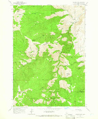
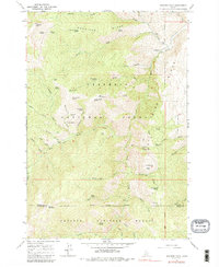
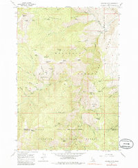
Editions of this 1964 Heavens Gate Map
4 editions found
Other maps of this area

1920 · Seven Devils Mining District
USGS Topo · 1:48,000

1922 · He Devil
USGS Topo · 1:48,000

1938 · Riggins
USGS Topo · 1:96,000

1945 · Riggins
USGS Topo · 1:125,000

1955 · Grangeville
USGS Topo · 1:250,000
1957 · He Devil
USGS Topo · 1:62,500
1957 · Cuprum
USGS Topo · 1:62,500

1959 · Grangeville
USGS Topo · 1:250,000
1963 · Indian Mountain
USGS Topo · 1:24,000
1963 · Pollock Mountain
USGS Topo · 1:24,000