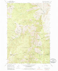
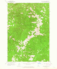
1964 Map of Heavens Gate
USGS Topo · Published 1986About this map
The Rapid River carves a deep path through the heart of the Nez Perce National Forest and Payette National Forest in this mid-century survey. High elevations are defined by prominent peaks like Cannon Ball Mountain and Mount Sampson, while the Rapid River Fish Hatchery stands as a significant landmark along the eastern watercourse. The map reveals a landscape punctuated by remote outposts and historic habitations, including Silvers Station, Potter Place, and Wurl Cabin, which suggest a legacy of high-country ranching or seasonal residency. This 1964 record, based on 1959 aerial photography, documents the intricate drainage network of the South Fork and West Fork McCrea Creek before modern developments could alter the terrain. From the lookout at Heavens Gate to the remote Wyatt Camp, the topography provides a clear view of the wilderness as it appeared during the height of post-war forestry and conservation efforts.
Find a feature on this map
60 named features on this map. Tap any name to fly to it.
Don’t see what you’re looking for? This feature index may not catch every label — zoom into the map to look around manually.
Map Details
Editions of this 1964 Heavens Gate Map
4 editions found
Other maps of this area

1920 · Seven Devils Mining District
USGS Topo · 1:48,000

1922 · He Devil
USGS Topo · 1:48,000

1938 · Riggins
USGS Topo · 1:96,000

1945 · Riggins
USGS Topo · 1:125,000

1955 · Grangeville
USGS Topo · 1:250,000

1957 · He Devil
USGS Topo · 1:62,500

1957 · Cuprum
USGS Topo · 1:62,500

1959 · Grangeville
USGS Topo · 1:250,000

1963 · Indian Mountain
USGS Topo · 1:24,000
1963 · Pollock Mountain
USGS Topo · 1:24,000