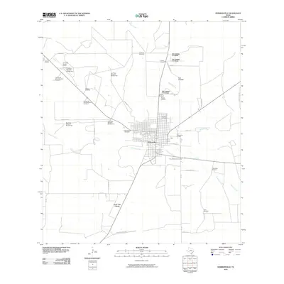
2010 Map of Hebbronville
USGS Topo · Published 2010About this map
Hebbronville serves as the central hub of this South Texas landscape, where the town grid is bounded by Mesquite Creek to the north and Noriacitas Creek to the south. The geography is defined by a series of distinct residential clusters including Las Lomitas and South Fork Colonia, reflecting the region's specific settlement patterns. Transportation and infrastructure are vital components of the area's layout, anchored by the Jim Hogg County Airport and the Dusty Downs Racetrack.
Find a feature on this map
45 named features on this map. Tap any name to fly to it.
Don’t see what you’re looking for? This feature index may not catch every label — zoom into the map to look around manually.
Map Details
Editions of this 2010 Hebbronville Map
This is the sole edition of this map. No revisions or reprints were ever made.
Other maps of this area

1939 · Bruni
USGS Topo · 1:62,500

1939 · Randado
USGS Topo · 1:62,500

1940 · Randado
USGS Topo · 1:62,500

1956 · Laredo
USGS Topo · 1:250,000

1967 · Hebbronville SE
USGS Topo · 1:24,000

1967 · Realitos
USGS Topo · 1:24,000

1967 · Hebbronville NW
USGS Topo · 1:24,000

1967 · Hebbronville
USGS Topo · 1:24,000

1972 · Armstrong Ranch
USGS Topo · 1:24,000

1972 · Bruni SE
USGS Topo · 1:24,000
Featured Places
- Hebbronville, TX
- South Fork Colonia, TX
- Las Lomitas A Colonia, TX
- Las Lomitas B Colonia, TX
- Las Lomitas C Colonia, TX