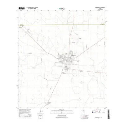
2016 Map of Hebbronville
USGS Topo · Published 2016About this map
Hebbronville serves as the central hub in this South Texas landscape, where the grid of city streets transitions into a vast network of ranch roads and ephemeral watercourses. The town's layout is meticulously detailed, showing residential blocks and public landmarks like the Jim Hogg County Airport to the northwest. Local history is anchored by the presence of three distinct burial grounds: the Old Hebbronville Cem, the New Hebbronville Cem, and Greenhill Cem, which mark the community's growth and generational ties. Beyond the settled area of Las Lomitas, the terrain is defined by ranching heritage, evidenced by named routes such as Gruy Ranch Rd, Reyna Ranch Rd, and Hellen Ranch Rd. These paths navigate a landscape of brush and drainages, including the Noriacitas Cr and the southern Arroyo de Magueyes.
Find a feature on this map
88 named features on this map. Tap any name to fly to it.
Don’t see what you’re looking for? This feature index may not catch every label — zoom into the map to look around manually.
Map Details
Editions of this 2016 Hebbronville Map
This is the sole edition of this map. No revisions or reprints were ever made.
Other maps of this area

1939 · Bruni
USGS Topo · 1:62,500

1939 · Randado
USGS Topo · 1:62,500

1940 · Randado
USGS Topo · 1:62,500

1956 · Laredo
USGS Topo · 1:250,000

1967 · Hebbronville SE
USGS Topo · 1:24,000

1967 · Realitos
USGS Topo · 1:24,000

1967 · Hebbronville NW
USGS Topo · 1:24,000

1967 · Hebbronville
USGS Topo · 1:24,000

1972 · Armstrong Ranch
USGS Topo · 1:24,000

1972 · Bruni SE
USGS Topo · 1:24,000
Featured Places
- Hebbronville, TX
- South Fork Colonia, TX
- Las Lomitas A Colonia, TX
- Las Lomitas B Colonia, TX
- Las Lomitas C Colonia, TX