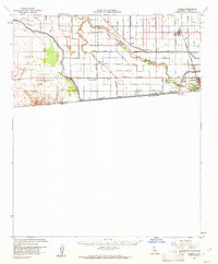
1957 Map of Heber
USGS Topo · Published 1961About this map
Calexico and Heber dominate this mid-century landscape in the Imperial Valley, revealing an intricate irrigation system that transformed the Yuha Desert. The map documents a strictly managed hydraulic economy, defined by the All American Canal and an expansive network of laterals and drains named after flowers and trees, such as the Dahlia Canal and Eucalyptus Canal. This infrastructure supports the agricultural settlements of Mount Signal and specialized sites like the Labor Camp.
Find a feature on this map
52 named features on this map. Tap any name to fly to it.
Don’t see what you’re looking for? This feature index may not catch every label — zoom into the map to look around manually.
Map Details
Editions of this 1957 Heber Map
2 editions found
Other maps of this area

1907 · Holtville
USGS Topo · 1:125,000

1915 · El Centro
USGS Topo · 1:125,000

1940 · Brawley
USGS Topo · 1:62,500

1940 · Heber
USGS Topo · 1:62,500

1940 · Plaster City
USGS Topo · 1:62,500

1940 · Alamorio
USGS Topo · 1:62,500

1940 · Coyote Wells
USGS Topo · 1:62,500

1940 · Calexico
USGS Topo · 1:62,500

1942 · El Centro
USGS Topo · 1:250,000

1943 · Coyote Wells
USGS Topo · 1:62,500