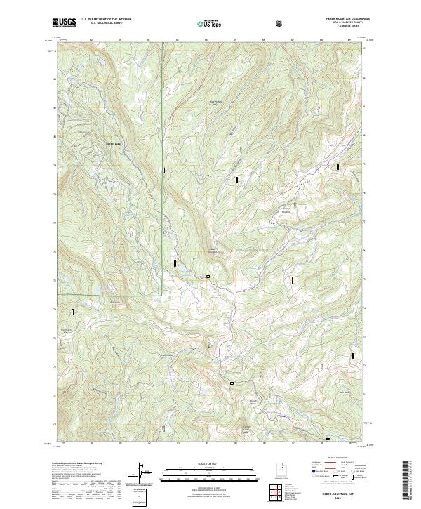
2023 Map of Heber Mountain
USGS Topo · Published 2023About this map
Timber Lakes serves as the primary residential hub on this high-altitude landscape, featuring a dense network of local roads such as Green Briar Rd and Blazing Star Way. Most of the area is contained within the Uinta National Forest, a terrain of high ridges and deep hollows that form the headwaters for several regional rivers. The geography is defined by prominent elevations like Heber Mountain and Currant Creek Peak, which overlook complex drainage systems including the Strawberry River and Little West Fork. Water management is evident through features like the Dee Mills Reservoir and Center Cr Number Five Reservoir. For recreational history, the map details numerous snowmobile trails, including the Mill Hollow Snowmo Groomed Trl and the Coop Creek Snowmo Groomed Trl, which follow the natural contours of the Duchesne Ridge.
Find a feature on this map
59 named features on this map. Tap any name to fly to it.
Don’t see what you’re looking for? This feature index may not catch every label — zoom into the map to look around manually.
Map Details
Editions of this 2023 Heber Mountain Map
This is the sole edition of this map. No revisions or reprints were ever made.
Other maps of this area

1885 · Salt Lake
USGS Topo · 1:250,000

1900 · Coalville
USGS Topo · 1:125,000

1903 · Coalville
USGS Topo · 1:125,000

1907 · Strawberry Valley
USGS Topo · 1:125,000

1909 · Strawberry Valley
USGS Topo · 1:125,000

1954 · Salt Lake City
USGS Topo · 1:250,000

1958 · Salt Lake City
USGS Topo · 1:250,000

1960 · Salt Lake City
USGS Topo · 1:250,000

1967 · Francis
USGS Topo · 1:24,000
1967 · Center Creek
USGS Topo · 1:24,000