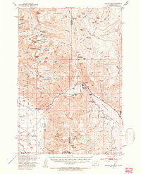
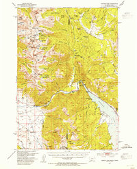
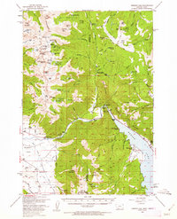
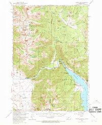
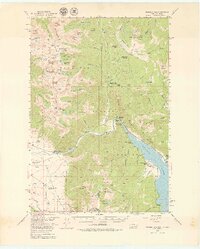
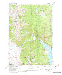
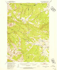
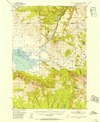
1950 Map of Hebgen Dam
USGS Topo · Published 1954About this map
The Hebgen Dam and the sprawling waters of Lake Hebgen anchor this mid-century survey of the high mountain terrain along the Montana-Idaho border. The landscape is defined by the high peaks of the Madison Range, including Hilgard Peak and Echo Peak, which shelter a dense network of alpine water bodies like Comet Lake and Blue Paradise Lake. This era shows a transition in land use within the Gallatin National Forest, where established working landscapes like the Olifee Ranch and Shaw Ranch coexist with emerging recreational sites such as Campfire Lodge and Hilgard Lodge.
Find a feature on this map
111 named features on this map. Tap any name to fly to it.
Don’t see what you’re looking for? This feature index may not catch every label — zoom into the map to look around manually.
Map Details
Editions of this 1950 Hebgen Dam Map
7 editions found

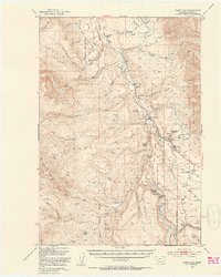
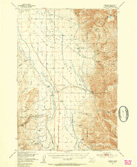
Other maps of this area

1888 · Three Forks
USGS Topo · 1:250,000

1894 · Three Forks
USGS Topo · 1:250,000

1895 · Three Forks
USGS Topo · 1:250,000

1947 · Bozeman
USGS Topo · 1:250,000

1948 · Bozeman
USGS Topo · 1:250,000
1950 · Cliff Lake
USGS Topo · 1:62,500
1950 · Cameron
USGS Topo · 1:62,500
1950 · Sphinx Mountain
USGS Topo · 1:62,500
1950 · Upper Red Rock Lake
USGS Topo · 1:62,500

1955 · Bozeman
USGS Topo · 1:250,000