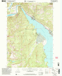
2000 Map of Hebgen Dam
USGS Topo · Published 2005About this map
Hebgen Lake and the surrounding high-elevation terrain of Gallatin National Forest dominate this landscape, which remains deeply defined by the 1959 Hebgen Lake earthquake. The map clearly identifies the Earthquake Area and the resulting Earthquake Lake, created when a massive landslide dammed the Madison River. Notable landmarks from this event include the Earthquake Scarp Exhibit and the somber Ghost Village, alongside evidence of the force of the disaster such as the label for building destruction near Clark Springs.
Find a feature on this map
35 named features on this map. Tap any name to fly to it.
Don’t see what you’re looking for? This feature index may not catch every label — zoom into the map to look around manually.
Map Details
Editions of this 2000 Hebgen Dam Map
This is the sole edition of this map. No revisions or reprints were ever made.
Other maps of this area

1950 · Hebgen Dam
USGS Topo · 1:62,500

1955 · Ashton
USGS Topo · 1:250,000

1958 · Ashton
USGS Topo · 1:250,000

1958 · West Yellowstone
USGS Topo · 1:62,500
1958 · Tepee Creek
USGS Topo · 1:62,500

1960 · Ashton
USGS Topo · 1:250,000

1964 · Targhee Pass
USGS Topo · 1:24,000

1964 · Targhee Peak
USGS Topo · 1:24,000

1964 · Henrys Lake
USGS Topo · 1:62,500
1986 · Madison Arm
USGS Topo · 1:24,000