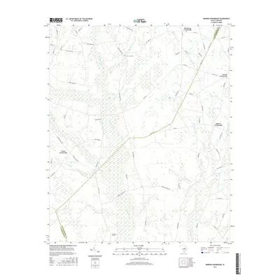
2017 Map of Hebron Crossroads
USGS Topo · Published 2017About this map
Barrineau Crossroads and Hebron Crossroads anchor a low-lying landscape defined by an intricate network of wetlands on the border of Clarendon and Williamsburg counties. This coastal plain region is dominated by expansive swamp systems, most notably the Douglas Swamp and Puddin Swamp, which create a complex drainage pattern throughout the quadrangle. The human geography is marked by small, dispersed rural settlements at strategic intersections, such as Terrell Crossroad and Union Crossroads. Local landmarks like Saint James Cem and McIntosh Airport provide points of interest for genealogists and local historians tracking family roots in this corner of South Carolina. The road network, featuring names like Hog Parlor Rd and Tram Rd, reflects the agricultural and industrial legacy of the area, where land use must navigate the persistent waters of Clapp Swamp and Cain Br.
Find a feature on this map
68 named features on this map. Tap any name to fly to it.
Don’t see what you’re looking for? This feature index may not catch every label — zoom into the map to look around manually.
Map Details
Editions of this 2017 Hebron Crossroads Map
This is the sole edition of this map. No revisions or reprints were ever made.
Other maps of this area

1920 · Mayesville
USGS Topo · 1:48,000

1920 · Manning
USGS Topo · 1:48,000

1921 · Manning
USGS Topo · 1:62,500

1921 · Mayesville
USGS Topo · 1:62,500

1943 · Mayesville
USGS Topo · 1:62,500

1944 · Manning
USGS Topo · 1:62,500

1946 · Kingstree
USGS Topo · 1:62,500

1946 · Lake City
USGS Topo · 1:62,500

1949 · Georgetown
USGS Topo · 1:250,000

1954 · Augusta
USGS Topo · 1:250,000
Featured Places
- Terrell Crossroad, SC
- Hebron Crossroads, SC
- Barrineau Crossroads, SC
- Union Crossroads, SC
- Clarendon County, SC