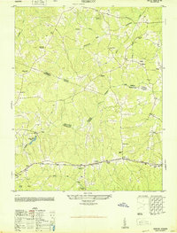
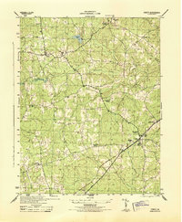
1950 Map of Hebron
USGS Topo · Published 1950About this map
The Norfolk and Western railroad corridor defines the southern landscape of this mid-century survey, linking the small communities of Wilson and Hebron across the borderlands of Amelia, Nottoway, and Dinwiddie Counties. This rural region is characterized by a dense network of local institutions that served the post-war agrarian population, including the King David Lodge Hall, Mission Light School, and Ammon School. The terrain is marked by numerous watercourses such as Winticomack Creek and Sweathouse Creek, which supported early local industry at sites like Hobbs Mill and its associated Hobbs Mill Ponds. Numerous small rural churches and family-named cemeteries, such as the Windmill Cem and Poplar Hill Church, are scattered throughout the wooded drainage basins of Namozine Creek, providing significant data points for genealogists and local historians studying these Virginia rural crossroads before modern development altered the historic settlement patterns.
Find a feature on this map
38 named features on this map. Tap any name to fly to it.
Don’t see what you’re looking for? This feature index may not catch every label — zoom into the map to look around manually.
Map Details
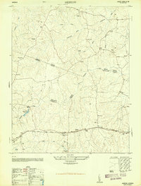
Editions of this 1950 Hebron Map
2 editions found
Other maps of this area

1897 · Amelia
USGS Topo · 1:125,000

1943 · Amelia
USGS Topo · 1:31,680

1943 · Goodes Bridge
USGS Topo · 1:31,680

1943 · De Witt
USGS Topo · 1:24,000

1943 · Church Road
USGS Topo · 1:24,000

1943 · Winterpock
USGS Topo · 1:24,000

1943 · Richmond
USGS Topo · 1:250,000
1944 · Winterpock
USGS Topo · 1:31,680
1944 · Church Road
USGS Topo · 1:31,680
1944 · DeWitt
USGS Topo · 1:31,680