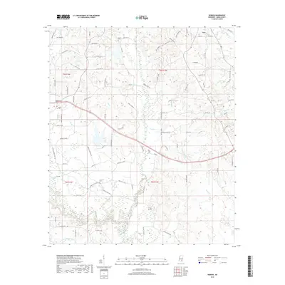
2018 Map of Hebron
USGS Topo · Published 2018About this map
Soso and Hebron anchor this rural landscape in Jones County, where a intricate network of family-named roads and cemeteries reveals the deep-rooted settlement patterns of the Piney Woods. The terrain is defined by a dense web of watercourses, including the notable Soso Big Creek, Reed Brake Br, and the oxbow waters of Horseshoe Lake. These creeks and branches historically dictated the placement of homesteads and the winding paths of local thoroughfares like Bernis Hill Rd and Tate Dr.
Find a feature on this map
100 named features on this map. Tap any name to fly to it.
Don’t see what you’re looking for? This feature index may not catch every label — zoom into the map to look around manually.
Map Details
Editions of this 2018 Hebron Map
This is the sole edition of this map. No revisions or reprints were ever made.
Other maps of this area

1953 · Hattiesburg
USGS Topo · 1:250,000

1958 · Hattiesburg
USGS Topo · 1:250,000

1964 · Moss
USGS Topo · 1:24,000

1964 · Laurel West
USGS Topo · 1:24,000

1964 · Seminary
USGS Topo · 1:24,000

1964 · Ellisville
USGS Topo · 1:24,000

1965 · Hebron
USGS Topo · 1:24,000

1965 · Hot Coffee
USGS Topo · 1:24,000

1965 · Moselle
USGS Topo · 1:24,000

1974 · Soso
USGS Topo · 1:24,000