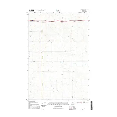
2014 Map of Hebron SE
USGS Topo · Published 2014About this map
The county line between Stark Co and Morton Co divides this high plains landscape, defined by the winding drainages of Heart Butte Cr and Beaver Cr. The terrain is marked by a rigorous section-line road grid, including 79th Ave NW and 40th St, which speaks to the enduring influence of the Public Land Survey System on North Dakota's agricultural development. This survey reveals how contemporary infrastructure like 38th St SW follows the same pathways established by early settlers, maintaining the geometric order of the prairie even as modern mapping technologies document the shifting course of local creek beds. Researchers will find a clear record of land division and the sparse but deliberate network of rural routes that sustain this expansive ranching and farming region.
Find a feature on this map
22 named features on this map. Tap any name to fly to it.
Don’t see what you’re looking for? This feature index may not catch every label — zoom into the map to look around manually.
Map Details
Editions of this 2014 Hebron SE Map
This is the sole edition of this map. No revisions or reprints were ever made.
Other maps of this area

1938 · Heart Butte
USGS Topo · 1:48,000

1944 · Heart Butte
USGS Topo · 1:62,500

1953 · Dickinson
USGS Topo · 1:250,000

1954 · Bismarck
USGS Topo · 1:250,000

1957 · Dickinson
USGS Topo · 1:250,000

1958 · Bismarck
USGS Topo · 1:250,000

1960 · Clark Butte NW
USGS Topo · 1:24,000

1960 · Heart Butte NW
USGS Topo · 1:24,000

1960 · Clark Butte NE
USGS Topo · 1:24,000
1970 · Glen Ullin NW
USGS Topo · 1:24,000