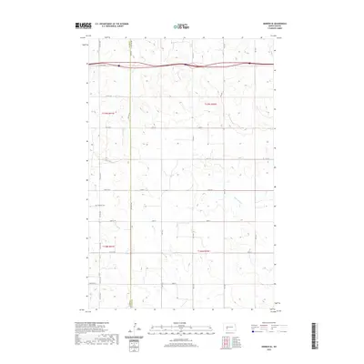
2020 Map of Hebron SE
USGS Topo · Published 2020About this map
The rugged High Plains topography where Stark Co meets Morton Co is characterized by a high-altitude drainage divide that channels water south through the meandering channels of Beaver Creek and Heart Butte Creek. This modern survey documents the sparse, section-line road network of the North Dakota grasslands, where long stretches of Co Rd 90 and numbered tracks like 45th St SW connect isolated farmsteads. A key genealogical landmark is the Antelope Cem, which remains a solitary historical anchor in this ranching and farming landscape south of the main interstate corridor. The map's contour lines reveal a complex system of draws and ridges that have historically dictated the placement of homesteads and water access in this semi-arid region.
Find a feature on this map
23 named features on this map. Tap any name to fly to it.
Don’t see what you’re looking for? This feature index may not catch every label — zoom into the map to look around manually.
Map Details
Editions of this 2020 Hebron SE Map
This is the sole edition of this map. No revisions or reprints were ever made.
Other maps of this area

1938 · Heart Butte
USGS Topo · 1:48,000

1944 · Heart Butte
USGS Topo · 1:62,500

1953 · Dickinson
USGS Topo · 1:250,000

1954 · Bismarck
USGS Topo · 1:250,000

1957 · Dickinson
USGS Topo · 1:250,000

1958 · Bismarck
USGS Topo · 1:250,000

1960 · Clark Butte NW
USGS Topo · 1:24,000

1960 · Heart Butte NW
USGS Topo · 1:24,000

1960 · Clark Butte NE
USGS Topo · 1:24,000
1970 · Glen Ullin NW
USGS Topo · 1:24,000