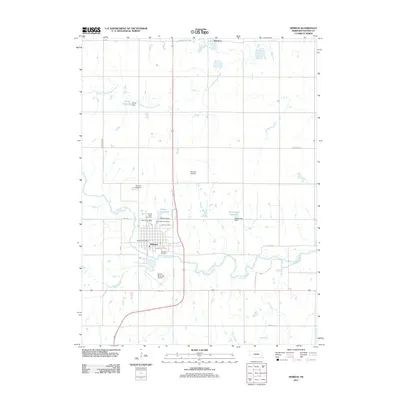
2011 Map of Hebron
USGS Topo · Published 2011About this map
The Little Blue River winds through the heart of Thayer County, anchoring the community of Hebron. This survey documents a prairie landscape managed by water engineering, featuring the Hebron Dam and several private catchments including the Elting Reservoir and Dondlinger Reservoir. For local historians and genealogists, the map is particularly detailed regarding burial sites, specifically identifying the Old Hebron Cemetery alongside the Sacred Heart Cemetery and Hebron Cemetery. The northern edge reaches toward Belvidere, while the central corridor is defined by Old US Hwy 81, connecting the municipal center to the surrounding agricultural grid. From the Hebron Post Office to the Hebron Municipal Airport, the map provides a precise layout of the town's early 21st-century infrastructure, including street-level detail such as Holdrege Ave and River Rd.
Find a feature on this map
34 named features on this map. Tap any name to fly to it.
Don’t see what you’re looking for? This feature index may not catch every label — zoom into the map to look around manually.
Map Details
Editions of this 2011 Hebron Map
This is the sole edition of this map. No revisions or reprints were ever made.
Other maps of this area

1898 · Hebron
USGS Topo · 1:125,000

1955 · Lincoln
USGS Topo · 1:250,000

1957 · Lincoln
USGS Topo · 1:250,000

1958 · Lincoln
USGS Topo · 1:250,000

1960 · Bruning
USGS Topo · 1:24,000

1960 · Chester
USGS Topo · 1:24,000

1960 · Hubbell
USGS Topo · 1:24,000

1960 · Carleton
USGS Topo · 1:24,000

1960 · Tobias SW
USGS Topo · 1:24,000

1960 · Alexandria
USGS Topo · 1:24,000