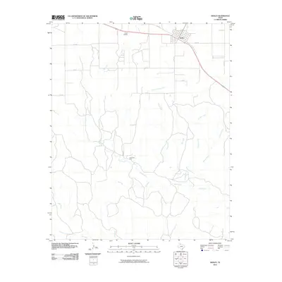
2010 Map of Hedley
USGS Topo · Published 2010About this map
Hedley serves as the primary focal point of this Donley County landscape, situated where the high plains begin to break into a network of drainages. The settlement's layout is defined by its position along the primary highway corridor, north of the branching waters of South Fork Buck Creek. To the west, the terrain is marked by Crow Hollow, while the central portion of the map is dominated by the winding path of Indian Creek and the localized Indiancreek Ranch.
Find a feature on this map
17 named features on this map. Tap any name to fly to it.
Don’t see what you’re looking for? This feature index may not catch every label — zoom into the map to look around manually.
Map Details
Editions of this 2010 Hedley Map
This is the sole edition of this map. No revisions or reprints were ever made.
Other maps of this area

1954 · Plainview
USGS Topo · 1:250,000

1958 · Plainview
USGS Topo · 1:250,000

1959 · Lelia Lake Creek
USGS Topo · 1:24,000

1959 · McKnight
USGS Topo · 1:24,000

1960 · Brice
USGS Topo · 1:62,500

1961 · Memphis
USGS Topo · 1:62,500

1962 · Lelia Lake
USGS Topo · 1:24,000

1963 · Hedley
USGS Topo · 1:24,000

1963 · Clarendon SE
USGS Topo · 1:24,000

1963 · Giles
USGS Topo · 1:24,000