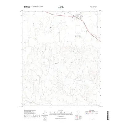
2019 Map of Hedley
USGS Topo · Published 2019About this map
Hedley serves as the primary focal point of this Panhandle landscape, where the town grid is established along 287 and Railroad St. The local geography is defined by a complex network of drainage systems, including the prominent Kilfoil Draw and Oklahoma Draw, which transition into numerous named creeks that carve through the Texas terrain. To the south, the water sources become more concentrated at Indian Creek Spring, feeding into Indian Cr and Dalton Cr. The settlement pattern follows the established county road system, with routes like Co Rd W and Co Rd 22 connecting the outlying ranch lands to the commercial center. This map captures the integration of transportation and natural hydrology, showing how the community developed around the intersection of the highway and the winding path of Bell Cr and Crow Hollow.
Find a feature on this map
39 named features on this map. Tap any name to fly to it.
Don’t see what you’re looking for? This feature index may not catch every label — zoom into the map to look around manually.
Map Details
Editions of this 2019 Hedley Map
This is the sole edition of this map. No revisions or reprints were ever made.
Other maps of this area

1954 · Plainview
USGS Topo · 1:250,000

1958 · Plainview
USGS Topo · 1:250,000

1959 · Lelia Lake Creek
USGS Topo · 1:24,000

1959 · McKnight
USGS Topo · 1:24,000

1960 · Brice
USGS Topo · 1:62,500

1961 · Memphis
USGS Topo · 1:62,500

1962 · Lelia Lake
USGS Topo · 1:24,000

1963 · Hedley
USGS Topo · 1:24,000

1963 · Clarendon SE
USGS Topo · 1:24,000

1963 · Giles
USGS Topo · 1:24,000