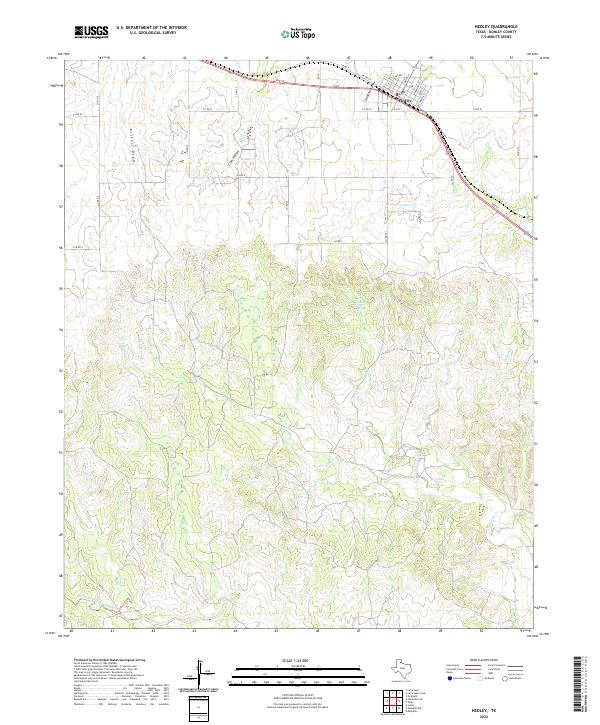
2022 Map of Hedley
USGS Topo · Published 2022About this map
Hedley serves as the primary settlement on this Donley County survey, situated at a junction where the town grid meets the regional transport artery of 2nd St. The landscape south of the townsite is defined by a dense network of watercourses and draws that drain toward the Oaks Creek system, including West Fork Oaks Creek and the meandering Indian Creek. These drainages, such as Kilfoil Draw and Oklahoma Draw, illustrate the complex erosion patterns typical of the Texas Panhandle's rolling plains.
Find a feature on this map
37 named features on this map. Tap any name to fly to it.
Don’t see what you’re looking for? This feature index may not catch every label — zoom into the map to look around manually.
Map Details
Editions of this 2022 Hedley Map
This is the sole edition of this map. No revisions or reprints were ever made.
Other maps of this area

1954 · Plainview
USGS Topo · 1:250,000

1958 · Plainview
USGS Topo · 1:250,000

1959 · Lelia Lake Creek
USGS Topo · 1:24,000

1959 · McKnight
USGS Topo · 1:24,000

1960 · Brice
USGS Topo · 1:62,500

1961 · Memphis
USGS Topo · 1:62,500

1962 · Lelia Lake
USGS Topo · 1:24,000

1963 · Hedley
USGS Topo · 1:24,000

1963 · Clarendon SE
USGS Topo · 1:24,000

1963 · Giles
USGS Topo · 1:24,000