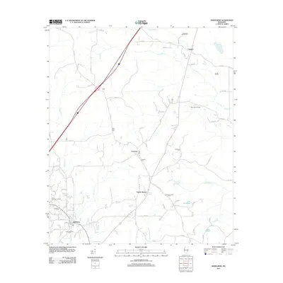
2012 Map of Heidelberg
USGS Topo · Published 2012About this map
The town of Heidelberg serves as the focal point for this 2012 survey, situated amidst a landscape heavily defined by its petroleum history. Industrial signatures like the Upper Tuscaloosa Oil Pool, East Heidelberg Oil Field, and Barnett Oil Field are prominent, illustrating the region's long-standing connection to resource extraction. For those tracing local heritage, the map identifies several key community sites including Vossburg, Stafford Springs, and Barnett, alongside local burial grounds such as Heidelberg Cem and Saint Peter Cem.
Find a feature on this map
93 named features on this map. Tap any name to fly to it.
Don’t see what you’re looking for? This feature index may not catch every label — zoom into the map to look around manually.
Map Details
Editions of this 2012 Heidelberg Map
This is the sole edition of this map. No revisions or reprints were ever made.
Other maps of this area

1953 · Hattiesburg
USGS Topo · 1:250,000

1953 · Meridian
USGS Topo · 1:250,000

1957 · Meridian
USGS Topo · 1:250,000

1957 · Enterprise
USGS Topo · 1:62,500

1958 · Hattiesburg
USGS Topo · 1:250,000

1963 · Waldrup
USGS Topo · 1:24,000

1963 · Heidelberg
USGS Topo · 1:24,000

1964 · Heidelberg SW
USGS Topo · 1:24,000

1964 · Sandersville
USGS Topo · 1:24,000

1964 · Eucutta
USGS Topo · 1:24,000