
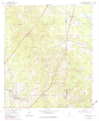
1963 Map of Heidelberg
USGS Topo · Published 1965About this map
The Southern railroad line serves as a central artery through this portion of Mississippi, connecting the communities of Barnett, Vossburg, and Heidelberg across the Jasper Co and Clarke Co border. This mid-century survey reveals a landscape deeply connected by small rural congregations and educational centers, including Salem Missionary Ch, Jerusalem Ch, and South Side High Sch.
Find a feature on this map
45 named features on this map. Tap any name to fly to it.
Don’t see what you’re looking for? This feature index may not catch every label — zoom into the map to look around manually.
Map Details
Editions of this 1963 Heidelberg Map
2 editions found
Other maps of this area

1953 · Hattiesburg
USGS Topo · 1:250,000

1953 · Meridian
USGS Topo · 1:250,000

1957 · Meridian
USGS Topo · 1:250,000

1957 · Enterprise
USGS Topo · 1:62,500

1958 · Hattiesburg
USGS Topo · 1:250,000

1963 · Waldrup
USGS Topo · 1:24,000

1964 · Heidelberg SW
USGS Topo · 1:24,000

1964 · Sandersville
USGS Topo · 1:24,000

1964 · Eucutta
USGS Topo · 1:24,000

1964 · Hale
USGS Topo · 1:24,000