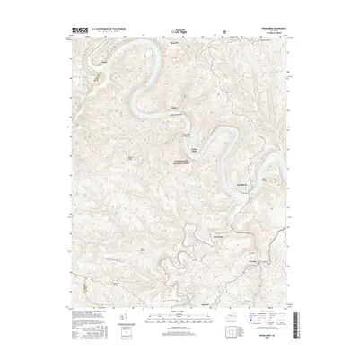
2016 Map of Heidelberg
USGS Topo · Published 2016About this map
The Kentucky River meanders through the heart of the Daniel Boone National Forest in this 2016 topographical survey, defining the landscape around Heidelberg and Willow. This riverine corridor is marked by significant features like Willow Shoals Bar and Long Willow Shoals Bar, which historically influenced local navigation and settlement patterns. The map highlights several dispersed communities, including Yellow Rock, Evelyn, and Cressmont, situated along the winding valley floors and protected ridges.
Find a feature on this map
25 named features on this map. Tap any name to fly to it.
Don’t see what you’re looking for? This feature index may not catch every label — zoom into the map to look around manually.
Map Details
Editions of this 2016 Heidelberg Map
This is the sole edition of this map. No revisions or reprints were ever made.
Other maps of this area

1891 · Manchester
USGS Topo · 1:125,000

1892 · Beattyville
USGS Topo · 1:125,000

1952 · Leighton
USGS Topo · 1:24,000

1952 · Beattyville
USGS Topo · 1:24,000

1952 · Cobhill
USGS Topo · 1:24,000

1952 · Heidelberg
USGS Topo · 1:24,000

1952 · Irvine
USGS Topo · 1:24,000

1953 · Mc Kee
USGS Topo · 1:24,000

1953 · Booneville
USGS Topo · 1:24,000

1953 · Sturgeon
USGS Topo · 1:24,000