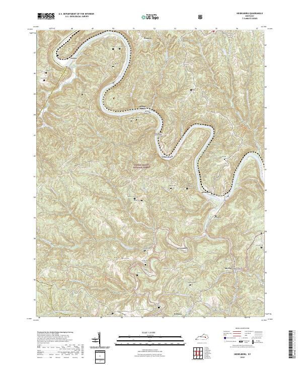
2022 Map of Heidelberg
USGS Topo · Published 2022About this map
The Kentucky River carves a deep, winding path through this portion of the Daniel Boone National Forest, defining the rugged geography of Lee and Owsley counties. Small riverside communities such as Evelyn, Yellow Rock, and Heidelberg are connected by a network of ridges and hollows, where family history is preserved in dozens of small burial grounds like Mayse Cem, Sparks Cem, and Angel Cem.
Find a feature on this map
67 named features on this map. Tap any name to fly to it.
Don’t see what you’re looking for? This feature index may not catch every label — zoom into the map to look around manually.
Map Details
Editions of this 2022 Heidelberg Map
This is the sole edition of this map. No revisions or reprints were ever made.
Other maps of this area

1891 · Manchester
USGS Topo · 1:125,000

1892 · Beattyville
USGS Topo · 1:125,000

1952 · Leighton
USGS Topo · 1:24,000

1952 · Beattyville
USGS Topo · 1:24,000

1952 · Cobhill
USGS Topo · 1:24,000

1952 · Heidelberg
USGS Topo · 1:24,000

1952 · Irvine
USGS Topo · 1:24,000

1953 · Mc Kee
USGS Topo · 1:24,000

1953 · Booneville
USGS Topo · 1:24,000

1953 · Sturgeon
USGS Topo · 1:24,000