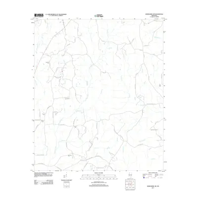
2012 Map of Heidelberg SW
USGS Topo · Published 2012About this map
Bogue Homo and the Little Bogue Homo define the drainage of this Jasper County landscape, where timber and petroleum production shape the rural character. Industrial activity is concentrated at the Bryan Oil Field and the West Eucutta Oil Field, which are networked by a complex system of local roads such as Beaver Meadow Rd and Hale Rd. For genealogists, the map identifies several distinct family and community burial sites, including McFarland Cem, Bethel Cem, and Zion Rest Cem. The terrain is deeply incised by numerous waterways like Eucutta Cr and Piney Cr, which dictate the winding paths of the county road network. The lack of concentrated municipal centers highlights a dispersed settlement pattern typical of Mississippi's Pine Belt region.
Find a feature on this map
84 named features on this map. Tap any name to fly to it.
Don’t see what you’re looking for? This feature index may not catch every label — zoom into the map to look around manually.
Map Details
Editions of this 2012 Heidelberg SW Map
This is the sole edition of this map. No revisions or reprints were ever made.
Other maps of this area

1953 · Hattiesburg
USGS Topo · 1:250,000

1958 · Hattiesburg
USGS Topo · 1:250,000

1963 · Waldrup
USGS Topo · 1:24,000

1963 · Heidelberg
USGS Topo · 1:24,000

1964 · Heidelberg SW
USGS Topo · 1:24,000

1964 · Sandersville
USGS Topo · 1:24,000

1964 · Eucutta
USGS Topo · 1:24,000

1964 · Laurel East
USGS Topo · 1:24,000

1964 · Myrick
USGS Topo · 1:24,000

1964 · Hale
USGS Topo · 1:24,000