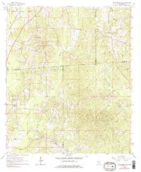
1964 Map of Heidelberg SW
USGS Topo · Published 1978About this map
The Old Indian Treaty Boundary slices diagonally across this Mississippi landscape, marking a historical division at the intersection of Jasper, Jones, Wayne, and Clarke counties. In the mid-1960s, this rural area was characterized by a dense network of small community institutions and specialized land use, including an Oil Field and numerous claypits. A significant concentration of spiritual and educational landmarks serves as a guide for local historians, from the Bogue Homo Sch to the McFarland Ch and Oakland Grove Cem.
Find a feature on this map
42 named features on this map. Tap any name to fly to it.
Don’t see what you’re looking for? This feature index may not catch every label — zoom into the map to look around manually.
Map Details
Editions of this 1964 Heidelberg SW Map
Other maps of this area

1953 · Hattiesburg
USGS Topo · 1:250,000

1958 · Hattiesburg
USGS Topo · 1:250,000

1963 · Waldrup
USGS Topo · 1:24,000

1963 · Heidelberg
USGS Topo · 1:24,000

1964 · Heidelberg SW
USGS Topo · 1:24,000

1964 · Sandersville
USGS Topo · 1:24,000

1964 · Eucutta
USGS Topo · 1:24,000

1964 · Laurel East
USGS Topo · 1:24,000

1964 · Myrick
USGS Topo · 1:24,000

1964 · Hale
USGS Topo · 1:24,000