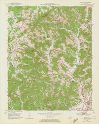
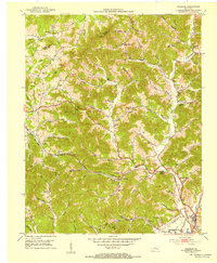
1952 Map of Heidrick
USGS Topo · Published 1972About this map
The waters of Little Richland Creek and the Middle Fork dominate this early 1950s survey of the Knox County landscape. The era’s economy is clearly visible through numerous Strip Mine operations scattered across the ridges and several Gas Well sites. Transportation and commerce are centered on the Louisville and Nashville railroad line, which connects small communities like Baileys Switch and Heidrick toward the southern edge near Barbourville. Local life is meticulously documented through an array of family landmarks and rural institutions, including Jarvis Store, Knox Fork Sch, and the Scott Chapel Cem. The map reveals a dense network of mountain hollows with evocative names like Booger Hollow and Red Worm Hollow, providing a detailed look at the rural Appalachian settlement patterns before modern development altered these Kentucky hillsides.
Find a feature on this map
90 named features on this map. Tap any name to fly to it.
Don’t see what you’re looking for? This feature index may not catch every label — zoom into the map to look around manually.
Map Details
Editions of this 1952 Heidrick Map
2 editions found
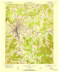
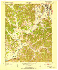
Other maps of this area

1886 · Cumberland Gap
USGS Topo · 1:125,000

1888 · Cumberland Gap
USGS Topo · 1:125,000

1890 · Williamsburg
USGS Topo · 1:125,000

1891 · Manchester
USGS Topo · 1:125,000

1891 · Cumberland Gap
USGS Topo · 1:125,000

1893 · London
USGS Topo · 1:125,000

1894 · Williamsburg
USGS Topo · 1:125,000

1897 · London
USGS Topo · 1:125,000
1952 · Corbin
USGS Topo · 1:24,000
1952 · Barbourville
USGS Topo · 1:24,000