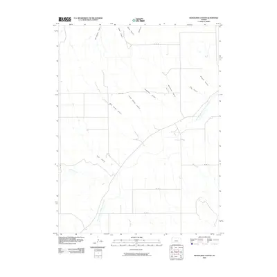
2009 Map of Heinzelman Canyon
USGS Topo · Published 2009About this map
The South Fork Republican River cuts through this northwestern Kansas landscape, creating a network of drainage systems characterized by a high density of named canyons. In this corner of Cheyenne County, the terrain is defined by dramatic landforms such as Heinzelman Canyon and Hells Canyon, which feed into the larger river valley. These features often bear the names of early local settlers or landowners, such as Will Stafford Canyon, Dave Harvey Canyon, and Arnold Harvey Canyon, offering a geographical record of family history in the region. The map also reveals the rural infrastructure of the early 21st century, with a grid of county roads like Co RD BB and Co RD DD providing access to the higher plains between the creek beds of Hackberry Creek and Bluff Creek.
Find a feature on this map
21 named features on this map. Tap any name to fly to it.
Don’t see what you’re looking for? This feature index may not catch every label — zoom into the map to look around manually.
Map Details
Editions of this 2009 Heinzelman Canyon Map
This is the sole edition of this map. No revisions or reprints were ever made.
Other maps of this area

1942 · St. Francis
USGS Topo · 1:62,500

1943 · St. Francis
USGS Topo · 1:62,500

1951 · St Francis
USGS Topo · 1:62,500

1951 · Bird City North
USGS Topo · 1:62,500

1954 · McCook
USGS Topo · 1:250,000

1954 · Goodland
USGS Topo · 1:250,000

1956 · Goodland
USGS Topo · 1:250,000

1957 · McCook
USGS Topo · 1:250,000

1957 · Goodland
USGS Topo · 1:250,000

1958 · McCook
USGS Topo · 1:250,000