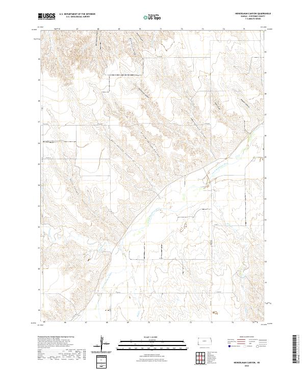
2022 Map of Heinzelman Canyon
USGS Topo · Published 2022About this map
The S Fork Republican River cuts a primary corridor through this section of Cheyenne County, creating a complex network of drainage systems and high ground. The landscape is defined by its numerous named canyons, which often carry the names of early residents or families, such as Dave Harvey Canyon, Arnold Harvey Canyon, and Will Stafford Canyon. These geological features suggest a history of ranching and land use where the topography dictated movement and settlement patterns along the watercourses of Hackberry Cr and Bluff Cr.
Find a feature on this map
30 named features on this map. Tap any name to fly to it.
Don’t see what you’re looking for? This feature index may not catch every label — zoom into the map to look around manually.
Map Details
Editions of this 2022 Heinzelman Canyon Map
This is the sole edition of this map. No revisions or reprints were ever made.
Other maps of this area

1942 · St. Francis
USGS Topo · 1:62,500

1943 · St. Francis
USGS Topo · 1:62,500

1951 · St Francis
USGS Topo · 1:62,500

1951 · Bird City North
USGS Topo · 1:62,500

1954 · McCook
USGS Topo · 1:250,000

1954 · Goodland
USGS Topo · 1:250,000

1956 · Goodland
USGS Topo · 1:250,000

1957 · McCook
USGS Topo · 1:250,000

1957 · Goodland
USGS Topo · 1:250,000

1958 · McCook
USGS Topo · 1:250,000