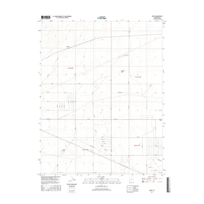
2017 Map of Heist
USGS Topo · Published 2017About this map
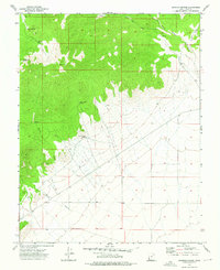
Escalante Desert terrain dominates this 2017 survey of western Iron County, where a rigid grid of agricultural and access roads imposes order on the arid basin. The namesake settlement of Heist sits along a diagonal rail or utility corridor that cuts across the northern sections, while the prominent Gray Knoll provides a rare point of elevation in the southwestern corner. The landscape is defined by the ephemeral drainage of Hogans Wash, which meanders eastward toward the quadrangle boundary. Local travel is facilitated by a network of named tracks such as W Old Modena Rd, Hunt Rd, and the curiously named Sundowner. The mapping reveals a transition between large open desert tracts and the beginnings of rural land division, evidenced by the alignment of roads like Antelope Rd and various numbered longitudinal routes.
Find a feature on this map
30 named features on this map. Tap any name to fly to it.
Don’t see what you’re looking for? This feature index may not catch every label — zoom into the map to look around manually.
Map Details
Editions of this 2017 Heist Map
This is the sole edition of this map. No revisions or reprints were ever made.
Other maps of this area

1885 · St. George
USGS Topo · 1:250,000

1891 · St. George
USGS Topo · 1:250,000

1953 · Cedar City
USGS Topo · 1:250,000

1958 · Cedar City
USGS Topo · 1:250,000

1962 · Cedar City
USGS Topo · 1:250,000
1972 · Modena
USGS Topo · 1:24,000
1972 · Beryl
USGS Topo · 1:24,000
1972 · Yale Crossing
USGS Topo · 1:24,000
1972 · Bannion Spring
USGS Topo · 1:24,000

1972 · Pinon Point
USGS Topo · 1:24,000