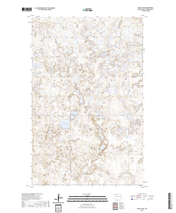
2024 Map of Helde Lake
USGS Topo · Published 2024About this map
Glacial prairie potholes and scattered wetlands define the landscape of northwestern North Dakota in this recent survey. Significant portions of the terrain are dedicated to conservation, most notably the Burke County Waterfowl Production Area, which spans multiple sections. This area of the Missouri Coteau is characterized by an intricate network of water bodies, including Helde Lake, Johnsons Lake, and Jud Chrests Lake. The road system follows a strict township and range grid, with routes like Co Rd 11 and 90th St NW providing access to the remote wetlands. These water features, such as Sand Slough and Swim Lake, represent the region's importance as a critical habitat within the Central Flyway. The map captures a largely unpopulated rural environment where public land management and agricultural boundaries meet.
Find a feature on this map
28 named features on this map. Tap any name to fly to it.
Don’t see what you’re looking for? This feature index may not catch every label — zoom into the map to look around manually.
Map Details
Editions of this 2024 Helde Lake Map
This is the sole edition of this map. No revisions or reprints were ever made.
Other maps of this area

1948 · Beaver Lake
USGS Topo · 1:24,000

1948 · Woburn
USGS Topo · 1:24,000

1949 · Rennie Lake
USGS Topo · 1:24,000

1950 · Flaxton
USGS Topo · 1:62,500

1950 · Portal
USGS Topo · 1:62,500

1953 · Williston
USGS Topo · 1:250,000

1957 · Williston
USGS Topo · 1:250,000
1974 · Thompson Lake
USGS Topo · 1:24,000
1974 · Helde Lake
USGS Topo · 1:24,000

1974 · Grubb Lake
USGS Topo · 1:24,000