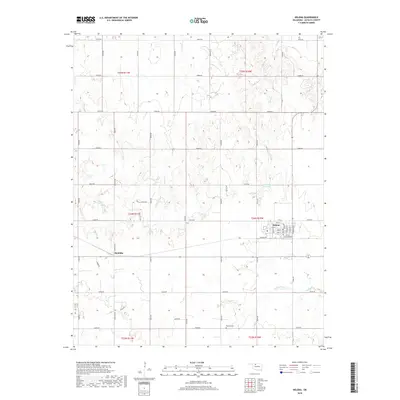
2018 Map of Helena
USGS Topo · Published 2018About this map
Helena stands as the primary hub in this Alfalfa County landscape, where a grid of rural section roads like E0320 Rd and N2650 Rd defines the agricultural layout. The town's interior structure is visible through its street network, including Main St and Kingman St, along with the central Po. To the southwest, the smaller settlement of McWillie sits along the rail corridor, while the southern boundary is marked by Rupert Cem. The terrain is drained by several seasonal watercourses including Turkey Creek and Spring Cr, which feed into local catchments like 003001 Reservoir. This 2018 survey illustrates the persistence of the Public Land Survey System (PLSS) in Oklahoma, with townships such as t24n r10w neatly organized into sections that dictate the placement of farmsteads and the orientation of the region's transport network.
Find a feature on this map
48 named features on this map. Tap any name to fly to it.
Don’t see what you’re looking for? This feature index may not catch every label — zoom into the map to look around manually.
Map Details
Editions of this 2018 Helena Map
This is the sole edition of this map. No revisions or reprints were ever made.
Other maps of this area

1955 · Woodward
USGS Topo · 1:250,000

1956 · Ringwood
USGS Topo · 1:62,500

1958 · Woodward
USGS Topo · 1:250,000

1968 · Carmen
USGS Topo · 1:24,000

1969 · Jet
USGS Topo · 1:24,000

1969 · Goltry
USGS Topo · 1:24,000

1969 · Lambert
USGS Topo · 1:24,000

1969 · Fairview NE
USGS Topo · 1:24,000

1969 · Helena
USGS Topo · 1:24,000

1969 · Cleo Springs
USGS Topo · 1:24,000