2022 Map of Helena
USGS Topo · Published 2022About this map
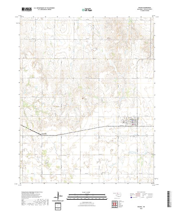
Helena serves as the primary municipal center in this section of Alfalfa County, its residential blocks organized around a street grid including Main St and Bond St. The surrounding township is defined by the rigid geometry of the Public Land Survey System, with gravel and section roads like N2630 Rd and E0300 Rd following township and range lines across the plains. West of the main town site, the settlement of McWillie sits along the road network, marking a secondary point of historical interest for local researchers.
Find a feature on this map
40 named features on this map. Tap any name to fly to it.
Don’t see what you’re looking for? This feature index may not catch every label — zoom into the map to look around manually.
Map Details
Editions of this 2022 Helena Map
This is the sole edition of this map. No revisions or reprints were ever made.