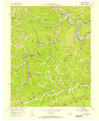
1954 Map of Hellier
USGS Topo · Published 1956About this map
The Chesapeake and Ohio railway winds through the narrow valleys of Pike County in the mid-1950s, serving a string of coal-dependent settlements like Hellier, Marrowbone, and Ashcamp. This era was defined by intensive extraction, visible in the heavy industrial presence of the Allegheny Mine and adjacent Coke Ovens. The landscape is a network of hollows—such as Rockhouse Fork and Wolfpit Branch—where family life and industry were closely integrated. Small community institutions are numerous, including Upper Wolfpit Sch and Jackson Br Sch, alongside family burial grounds like Ratliff Cem. South of the mining operations, the topography rises sharply toward Pine Mountain and the border with Dickenson County, Virginia, marked by Skeet Rock Knob. The map's detail, sourced from aerial photography and coal company records, provides a clear view of the winding mountain roads and the tightly packed infrastructure of the Cumberland Plateau.
Find a feature on this map
85 named features on this map. Tap any name to fly to it.
Don’t see what you’re looking for? This feature index may not catch every label — zoom into the map to look around manually.
Map Details
Editions of this 1954 Hellier Map
3 editions found
Other maps of this area

1886 · Grundy
USGS Topo · 1:125,000

1890 · Whitesburg
USGS Topo · 1:125,000

1890 · Grundy
USGS Topo · 1:125,000

1892 · Grundy
USGS Topo · 1:125,000

1892 · Whitesburg
USGS Topo · 1:125,000

1912 · Pound
USGS Topo · 1:48,000

1913 · Clintwood
USGS Topo · 1:62,500

1914 · Pound
USGS Topo · 1:62,500

1914 · Vergie
USGS Topo · 1:48,000

1915 · Clintwood
USGS Topo · 1:62,500