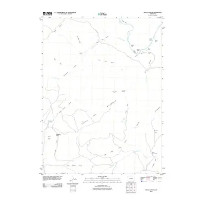
2010 Map of Hells Canyon
USGS Topo · Published 2010About this map
Hells Canyon and the Yampa River define this corner of Northwest Colorado, where the landscape transitions from high desert benches to deep limestone gorges. The 2010 survey highlights several isolated outposts of human activity including Red Rock Ranch, Mantle Ranch, and the Robinson Place. These remote holdings are situated among distinctive geological landmarks like The Billiard Table and Katys Nipple, illustrating the challenges of high-plateau ranching in Moffat County. Water sources are critical in this arid environment, evidenced by labels for Mud Spring, Bobcat Springs, and the Red Rock Reservoir. The presence of the Round Top Lookout atop Round Top Mountain indicates the area's strategic importance for monitoring the surrounding wilderness. From the northern reaches of Outlaw Park to the southern cattle operations at Mantle Summer Camp, the map documents a territory where geography still dictates the terms of settlement.
Find a feature on this map
41 named features on this map. Tap any name to fly to it.
Don’t see what you’re looking for? This feature index may not catch every label — zoom into the map to look around manually.
Map Details
Editions of this 2010 Hells Canyon Map
This is the sole edition of this map. No revisions or reprints were ever made.
Other maps of this area

1885 · Ashley
USGS Topo · 1:250,000

1907 · Rangely
USGS Topo · 1:125,000

1907 · Jensen
USGS Topo · 1:125,000

1910 · Jensen
USGS Topo · 1:125,000

1910 · Rangely
USGS Topo · 1:125,000

1954 · Hells Canyon
USGS Topo · 1:24,000

1954 · Canyon of Lodore South
USGS Topo · 1:24,000

1954 · Vernal
USGS Topo · 1:250,000

1955 · Stuntz Reservoir
USGS Topo · 1:24,000

1955 · Jones Hole
USGS Topo · 1:24,000