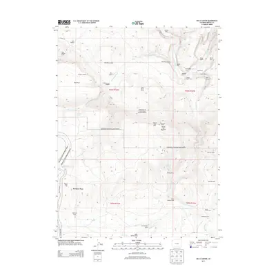
2013 Map of Hells Canyon
USGS Topo · Published 2013About this map
Dinosaur National Monument encompasses the majority of this landscape, where the Yampa River carves a deep path through the canyonlands of northwest Colorado. This 2013 survey illustrates a rugged intersection of federal protection and legacy ranching, with the Red Rock Ranch, Mantle Ranch, and Robinson Place situated amidst complex topography. High elevations are punctuated by landmarks such as Buena Vista Peak and Round Top Mountain, the latter featuring the Round Top Lookout. The map also captures the stark geological character of the region, identifying unique formations like The Billard Table, Katys Nipple, and Sand Canyon Arch. Water sources in this arid environment are carefully documented, from the seasonal The Slough and Bobcat Springs to the Red Rock Reservoir, which supports the sparse human activity in the area.
Find a feature on this map
51 named features on this map. Tap any name to fly to it.
Don’t see what you’re looking for? This feature index may not catch every label — zoom into the map to look around manually.
Map Details
Editions of this 2013 Hells Canyon Map
This is the sole edition of this map. No revisions or reprints were ever made.
Other maps of this area
1885 · Ashley
USGS Topo · 1:250,000
1907 · Rangely
USGS Topo · 1:125,000
1907 · Jensen
USGS Topo · 1:125,000
1910 · Jensen
USGS Topo · 1:125,000
1910 · Rangely
USGS Topo · 1:125,000
1954 · Hells Canyon
USGS Topo · 1:24,000
1954 · Canyon of Lodore South
USGS Topo · 1:24,000

1954 · Vernal
USGS Topo · 1:250,000
1955 · Stuntz Reservoir
USGS Topo · 1:24,000
1955 · Jones Hole
USGS Topo · 1:24,000