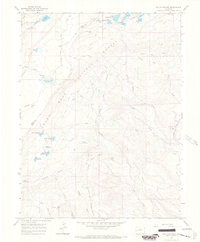
1965 Map of Hells Kitchen
USGS Topo · Published 1968About this map
Grand Mesa National Forest dominates this mid-1960s survey, revealing a landscape defined by an intricate network of water management and resource extraction. The terrain is marked by a vast array of high-altitude water bodies, from the prominent Granby Reservoirs cluster in the northeast to isolated catchments like Porter Reservoir No 1 and Morris Reservoir. This infrastructure supported the surrounding ranching and mining operations, evident in the presence of the Fairview Mine and Rollins Mine.
Find a feature on this map
54 named features on this map. Tap any name to fly to it.
Don’t see what you’re looking for? This feature index may not catch every label — zoom into the map to look around manually.
Map Details
Editions of this 1965 Hells Kitchen Map
3 editions found
Other maps of this area

1955 · Grand Mesa
USGS Topo · 1:24,000

1955 · Skyway
USGS Topo · 1:24,000

1956 · Montrose
USGS Topo · 1:250,000

1956 · Moab
USGS Topo · 1:250,000

1956 · Grand Junction
USGS Topo · 1:250,000

1957 · Leadville
USGS Topo · 1:250,000

1959 · Grand Junction
USGS Topo · 1:250,000

1959 · Moab
USGS Topo · 1:250,000

1959 · Leadville
USGS Topo · 1:250,000

1959 · Montrose
USGS Topo · 1:250,000