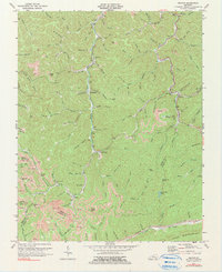
1974 Map of Helton
USGS Topo · Published 1991About this map
The Middle Fork Kentucky River defines the central corridor of this Leslie County landscape, where small settlements and community landmarks cluster along the valley floors. In the mid-1970s, the region was a mix of established mountain hamlets like Warbranch and Helton and active extraction sites, evidenced by numerous Strip Mines and scattered Mines that follow the coal seams. Cultural life is anchored by institutions such as Warbranch Ch, Middle Fork Ch, and the Beech Fork Sch, reflecting the deep-rooted social fabric of the Kentucky Appalachians.
Find a feature on this map
100 named features on this map. Tap any name to fly to it.
Don’t see what you’re looking for? This feature index may not catch every label — zoom into the map to look around manually.
Map Details
Editions of this 1974 Helton Map
2 editions found
Other maps of this area

1886 · Cumberland Gap
USGS Topo · 1:125,000

1887 · Jonesville
USGS Topo · 1:125,000

1888 · Cumberland Gap
USGS Topo · 1:125,000

1891 · Manchester
USGS Topo · 1:125,000

1891 · Cumberland Gap
USGS Topo · 1:125,000

1891 · Hazard
USGS Topo · 1:125,000

1891 · Jonesville
USGS Topo · 1:125,000

1903 · Harlan
USGS Topo · 1:48,000

1903 · Pineville
USGS Topo · 1:48,000

1916 · Harlan
USGS Topo · 1:48,000