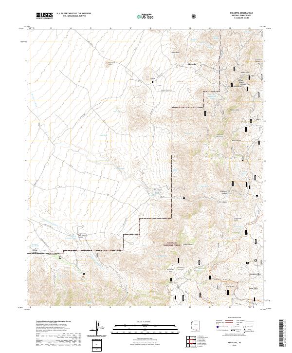
2021 Map of Helvetia
USGS Topo · Published 2021About this map
The Santa Rita Mountains dominate this high-desert landscape in Pima County, where the mining-era settlements of Helvetia and Greaterville sit at the fringes of the Coronado National Forest. This 2021 survey illustrates a region defined by steep canyons and seasonal water sources, with the Helvetia Cem serving as a primary genealogical landmark near the northern slopes. The intricate network of drainage is visible through features like Box Canyon Wash and Sawmill Canyon Wash, which carve through the foothills near Peach Knob and Huerfano Butte. Numerous named springs, including Shamrock Spring and Zackendorf Spring, highlight the critical role of water management in this arid environment. The map also traces the modern Arizona National Scenic Trail as it winds through rugged passes such as Gunsight Pass and Melendrez Pass, connecting historic gulches like Ophir Gulch and California Gulch.
Find a feature on this map
77 named features on this map. Tap any name to fly to it.
Don’t see what you’re looking for? This feature index may not catch every label — zoom into the map to look around manually.
Map Details
Editions of this 2021 Helvetia Map
This is the sole edition of this map. No revisions or reprints were ever made.
Other maps of this area

1904 · Patagonia
USGS Topo · 1:125,000

1905 · Patagonia
USGS Topo · 1:125,000

1922 · Agus Caliente
USGS Topo · 1:62,500

1926 · Helvetia
USGS Topo · 1:62,500

1932 · Elgin
USGS Topo · 1:62,500

1940 · Elgin
USGS Topo · 1:62,500

1947 · Elgin
USGS Topo · 1:62,500

1948 · Sonoita
USGS Topo · 1:24,000

1956 · Nogales
USGS Topo · 1:250,000

1958 · Nogales
USGS Topo · 1:250,000