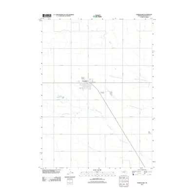
2011 Map of Hemingford
USGS Topo · Published 2011About this map
Hemingford serves as the central hub of this High Plains landscape, situated at the intersection of a sprawling rural road network and the local rail line. The village is well-documented with municipal landmarks including the Hemingford Post Office and the Box Butte County Fairgrounds on the northern edge of town. This survey illustrates how the community is anchored by agricultural infrastructure, with section-line roads like Dakota Rd and Grant Rd defining the territory.
Find a feature on this map
25 named features on this map. Tap any name to fly to it.
Don’t see what you’re looking for? This feature index may not catch every label — zoom into the map to look around manually.
Map Details
Editions of this 2011 Hemingford Map
This is the sole edition of this map. No revisions or reprints were ever made.
Other maps of this area

1946 · Nonpareil
USGS Topo · 1:24,000

1946 · Box Butte Reservoir West
USGS Topo · 1:24,000

1947 · Box Butte NW
USGS Topo · 1:24,000

1948 · Box Butte Reservoir West
USGS Topo · 1:24,000

1948 · Hemingford
USGS Topo · 1:24,000

1948 · Berea Creek West
USGS Topo · 1:24,000

1948 · Hemingford 4 NE
USGS Topo · 1:24,000

1948 · Hemingford 4 NW
USGS Topo · 1:24,000

1948 · Nonpareil
USGS Topo · 1:24,000

1948 · Box Butte Reservoir East
USGS Topo · 1:24,000