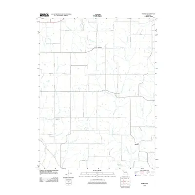
2012 Map of Hemple
USGS Topo · Published 2012About this map
Hemple and Starfield anchor this rural DeKalb County landscape, where the drainage patterns of Northwest Missouri define the layout of local roads and farmsteads. The terrain is deeply incised by a dense network of watercourses, including Castile Creek, Wolfpen Creek, and McGuire Branch, which dictate the winding paths of rural routes such as Co Rd-350 and Co Rd-376. For family historians, the map identifies specific burial grounds like New Harmony Cemetery and Keller Cemetery, situated away from the primary settlements. The land use remains predominantly agricultural, with a grid-like road system that frequently yields to the natural contours of the many small tributaries like Jordan Creek and Roger Branch that flow through the township.
Find a feature on this map
35 named features on this map. Tap any name to fly to it.
Don’t see what you’re looking for? This feature index may not catch every label — zoom into the map to look around manually.
Map Details
Editions of this 2012 Hemple Map
This is the sole edition of this map. No revisions or reprints were ever made.
Other maps of this area

1923 · Clarksdale
USGS Topo · 1:62,500

1923 · Maysville
USGS Topo · 1:62,500

1925 · Gower
USGS Topo · 1:62,500

1925 · Clarksdale
USGS Topo · 1:62,500

1925 · Plattsburg
USGS Topo · 1:62,500

1925 · Maysville
USGS Topo · 1:62,500

1950 · Kansas City
USGS Topo · 1:250,000

1951 · Edgerton
USGS Topo · 1:24,000
1951 · Gower
USGS Topo · 1:24,000

1954 · Kansas City
USGS Topo · 1:250,000