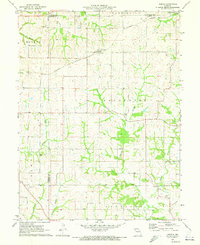
1971 Map of Hemple
USGS Topo · Published 1973About this map
Hemple and Starfield anchor this rural landscape at the intersection of Buchanan, Clinton, and De Kalb counties. The agricultural character of the region is defined by a dense network of watercourses, including Castile Creek, Malden Creek, and Jordan Creek, which carve through the townships of Marion, Washington, Lafayette, and Tremont. Transportation in the early 1970s was dominated by the Burlington Northern railroad, which passes through the northern portion of the map near the town of Stewartsville. Local history and genealogy are well-represented by several landmarks, including Freeman Chapel, Mt Zion Ch, and the New Harmony Cem. A distinctive Radio Tower stands in the southwestern quadrant, providing a modern navigational marker amidst the traditional farmstead and creek-bottom terrain.
Find a feature on this map
28 named features on this map. Tap any name to fly to it.
Don’t see what you’re looking for? This feature index may not catch every label — zoom into the map to look around manually.
Map Details
Editions of this 1971 Hemple Map
This is the sole edition of this map. No revisions or reprints were ever made.
Other maps of this area

1923 · Clarksdale
USGS Topo · 1:62,500

1923 · Maysville
USGS Topo · 1:62,500

1925 · Gower
USGS Topo · 1:62,500

1925 · Clarksdale
USGS Topo · 1:62,500

1925 · Plattsburg
USGS Topo · 1:62,500

1925 · Maysville
USGS Topo · 1:62,500

1950 · Kansas City
USGS Topo · 1:250,000

1951 · Edgerton
USGS Topo · 1:24,000
1951 · Gower
USGS Topo · 1:24,000

1954 · Kansas City
USGS Topo · 1:250,000