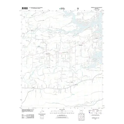
2011 Map of Hempwallace
USGS Topo · Published 2011About this map
Mazarn Creek and the Ouachita River frame a landscape defined by its waterways and small rural settlements. This 2011 survey illustrates the residential layout of Hempwallace and the eastern edge of Sunshine, showing a dense network of local roads such as Timberlake Rd and Thornton Ferry Rd. The map is a valuable resource for genealogists and local historians, as it precisely locates community landmarks like the Memorial Gardens Cemetery, Aldrich Cemetery, and Rush Fork Cemetery.
Find a feature on this map
152 named features on this map. Tap any name to fly to it.
Don’t see what you’re looking for? This feature index may not catch every label — zoom into the map to look around manually.
Map Details
Editions of this 2011 Hempwallace Map
This is the sole edition of this map. No revisions or reprints were ever made.
Other maps of this area

1890 · Hot Springs
USGS Topo · 1:125,000

1894 · Hot Springs
USGS Topo · 1:125,000

1955 · Little Rock
USGS Topo · 1:250,000

1956 · Little Rock
USGS Topo · 1:250,000

1960 · Little Rock
USGS Topo · 1:250,000

1962 · Crystal Springs
USGS Topo · 1:24,000

1964 · Little Rock
USGS Topo · 1:250,000

1966 · Pearcy
USGS Topo · 1:24,000
1966 · Hot Springs North
USGS Topo · 1:24,000

1966 · Hempwallace
USGS Topo · 1:24,000