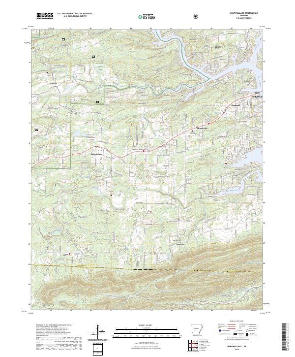
2024 Map of Hempwallace
USGS Topo · Published 2024About this map
Ouachita National Forest dominates the northern reaches of this region, where the Ouachita River snakes toward the residential developments of Piney and Rockwell. The landscape transitions from the protected timberlands near Kelly Creek and Mazarn Creek into a network of small communities and rural family holdings. Notable clusters of local history are found at the various burial grounds, including Oak Grove Cem and Aldrich Cem, which serve as anchors for the surrounding settlements. To the south, the terrain rises significantly toward Trap Mtn, overlooking the Garland and Hot Spring county line. The area's geography is defined by its water systems, from the larger river and Roberts Lake to the smaller drainage of Fourche a Loupe Creek, illustrating a pattern of development closely tied to the natural topography of the Ouachita foothills.
Find a feature on this map
38 named features on this map. Tap any name to fly to it.
Don’t see what you’re looking for? This feature index may not catch every label — zoom into the map to look around manually.
Map Details
Editions of this 2024 Hempwallace Map
This is the sole edition of this map. No revisions or reprints were ever made.
Other maps of this area

1890 · Hot Springs
USGS Topo · 1:125,000

1894 · Hot Springs
USGS Topo · 1:125,000

1955 · Little Rock
USGS Topo · 1:250,000

1956 · Little Rock
USGS Topo · 1:250,000

1960 · Little Rock
USGS Topo · 1:250,000

1962 · Crystal Springs
USGS Topo · 1:24,000

1964 · Little Rock
USGS Topo · 1:250,000

1966 · Pearcy
USGS Topo · 1:24,000
1966 · Hot Springs North
USGS Topo · 1:24,000

1966 · Hempwallace
USGS Topo · 1:24,000