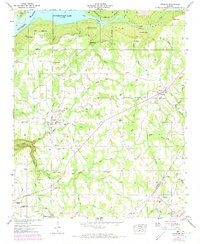
1947 Map of Henagar
USGS Topo · Published 1973About this map
Sand Mountain dominates this portion of Northeast Alabama, where the plateau landscape is carved by numerous drainages like Bryant Creek and Lick Creek. At the northern edge, the Tennessee River enters Guntersville Lake, bounded by the Guntersville Reservation Boundary. This 1947 survey, later updated with 1972 aerial data, captures the rural network of agricultural communities including Pisgah, Rosalie, and Henagar. The map reveals a high density of local landmarks essential for genealogical research, from the Lambert Chapel and Kings Chapel in the west to New Home Church and Mt Pisgah Ch further east. Industrial and natural features such as Morris Mill, a Strip Mine, and the Saltpetre Cave near Coon Creek offer a look at how the local economy and geography influenced settlement patterns before the modern expansion of these plateau towns.
Find a feature on this map
91 named features on this map. Tap any name to fly to it.
Don’t see what you’re looking for? This feature index may not catch every label — zoom into the map to look around manually.
Map Details
Editions of this 1947 Henagar Map
2 editions found
Other maps of this area

1886 · Stevenson
USGS Topo · 1:125,000

1892 · Stevenson
USGS Topo · 1:125,000

1895 · Stevenson
USGS Topo · 1:125,000

1936 · Ider
USGS Topo · 1:24,000

1936 · Wannville
USGS Topo · 1:24,000

1936 · Flat Rock
USGS Topo · 1:24,000

1936 · Dugout Valley
USGS Topo · 1:24,000

1936 · Dutton
USGS Topo · 1:24,000

1936 · Sylvania
USGS Topo · 1:24,000

1936 · Hollywood
USGS Topo · 1:24,000