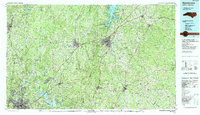
1991 Map of Henderson
USGS Topo · Published 1991About this map
The northern Piedmont of North Carolina is defined by the convergence of the Tar River and Flat River watersheds, anchored by the regional hubs of Henderson and Oxford. This 1991 survey illustrates the significant impact of mid-century water projects, specifically the John H Kerr Reservoir and the Falls Lake State Recreation Area, which reshaped the geography of Vance and Granville counties. The landscape is a mix of small municipal centers like Louisburg and Roxboro connected by a dense network of primary routes including Interstate 85 and U S Highway 1.
Find a feature on this map
120 named features on this map. Tap any name to fly to it.
Don’t see what you’re looking for? This feature index may not catch every label — zoom into the map to look around manually.
Map Details
Editions of this 1991 Henderson Map
2 editions found
Other maps of this area

1902 · Rocky Mount
USGS Topo · 1:62,500

1902 · Spring Hope
USGS Topo · 1:62,500

1904 · Rocky Mount
USGS Topo · 1:62,500

1904 · Springhope
USGS Topo · 1:62,500

1919 · White Plains
USGS Topo · 1:48,000

1920 · White Plains
USGS Topo · 1:62,500

1941 · Clarksville
USGS Topo · 1:48,000

1943 · Durham South
USGS Topo · 1:62,500

1943 · Clarksville
USGS Topo · 1:62,500

1943 · Raleigh
USGS Topo · 1:62,500