
1916 Map of Henderson
USGS Topo · Published 1916About this map
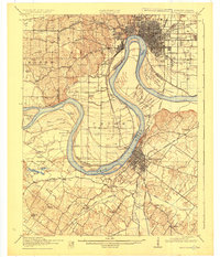
The Ohio River dominates this landscape, its winding course forming the critical border between Indiana and Kentucky just before World War I. The river's influence is evident in the dense network of wetlands such as Deep Slough and McClair Slough, while Lock and Dam No 48 marks an early era of navigational engineering. Major rail lines including the Louisville and Nashville RR and the Illinois Central RR converge here, supporting the riverfront industrial hubs of Evansville and Henderson.
Find a feature on this map
96 named features on this map. Tap any name to fly to it.
Don’t see what you’re looking for? This feature index may not catch every label — zoom into the map to look around manually.
Map Details
Editions of this 1916 Henderson Map
3 editions found
Other maps of this area

1901 · Haubstadt
USGS Topo · 1:62,500

1902 · Ditney
USGS Topo · 1:125,000

1902 · Boonville
USGS Topo · 1:62,500

1903 · Haubstadt
USGS Topo · 1:62,500

1903 · New Harmony
USGS Topo · 1:62,500

1903 · Patoka
USGS Topo · 1:125,000

1905 · Newburg
USGS Topo · 1:62,500

1906 · Sebree
USGS Topo · 1:62,500

1907 · Morganfield
USGS Topo · 1:62,500

1908 · Calhoun
USGS Topo · 1:62,500