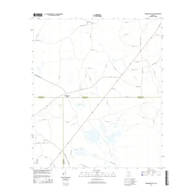
2014 Map of Henderson Still
USGS Topo · Published 2014About this map
Henderson Still serves as the focal point for this 2014 survey of the South Georgia flatwoods, where the borders of Atkinson, Lanier, and Clinch Counties converge. The landscape is defined by its unique Carolina Bay wetlands and sluggish drainages, most notably the distinctive Fifty Dollar Bay and Mullis Bay. These shallow, oval depressions are characteristic of the region, influencing the path of rural routes like Clay RD and Rushing RD that navigate the waterlogged terrain between Hog Creek and Mud Cr.
Find a feature on this map
57 named features on this map. Tap any name to fly to it.
Don’t see what you’re looking for? This feature index may not catch every label — zoom into the map to look around manually.
Map Details
Editions of this 2014 Henderson Still Map
This is the sole edition of this map. No revisions or reprints were ever made.
Other maps of this area

1953 · Waycross
USGS Topo · 1:250,000

1958 · Waycross
USGS Topo · 1:250,000

1968 · Lakeland
USGS Topo · 1:24,000

1971 · Pearson
USGS Topo · 1:24,000

1972 · Kirkland
USGS Topo · 1:24,000

1972 · Willacoochee
USGS Topo · 1:24,000

1972 · Sirmans
USGS Topo · 1:24,000

1972 · Sandy Bottom
USGS Topo · 1:24,000

1972 · Henderson Still
USGS Topo · 1:24,000
1977 · Hastings Fish Pond
USGS Topo · 1:24,000